Storm surge is a large dome of water often 50 to 100 miles wide that sweeps across the coastline near where a hurricane makes landfall. The surge of high water topped by waves is devastating. The stronger the hurricane and the shallower the offshore water, the higher the surge will be. Along the immediate coast, storm surge is the greatest threat to life and property.
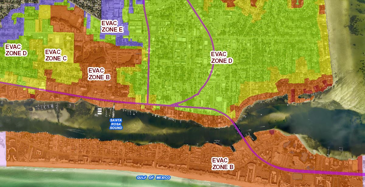
Available Evacuation Zone Maps
Destin Area
Fort Walton Beach Area
Niceville Area
Large Page Size, 36" x 24"
Small Page Size, 8.5" x 11"
Evacuation Routes & Shelters Map